Remote Sensing and GIS

2,000.00

Prof. Rishikesh Bharti

IIT Guwahati

*Additional GST and optional Exam fee are applicable.

SKU: IIT Guwahati Category:

Description

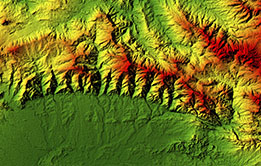
This course will introduce the students to the state-of-the-art concepts and practices of remote sensing and GIS. It starts with the fundamentals of remote sensing and GIS and subsequently advanced methods will be covered. This course is designed to give comprehensive understanding on the application of remote sensing and GIS in solving the research problems. Upon completion, the participants should be able to use remote sensing (Satellite images and Field data) and GIS in their future research work.

INTENDED AUDIENCE

UG, PG and PhD Students

INDUSTRY SUPPORT

Esri, Rolta India, RMSI Private Limited, ArcGeosystems

ABOUT THE INSTRUCTOR

Prof. Rishikesh Bharti is a faculty member at the Department of Civil Engineering, Indian Institute of Technology Guwahati. He has been teaching Advanced Remote Sensing, Geohazard Science and Engineering, Advanced Techniques in Geoscience, Engineering Geology to the B.Tech, M.Tech and PhD students at IIT Guwahati. Hydrogeomorphology, Geospatial modelling, Snow and Glacier Studies, Spectroscopy of natural & manmade materials and Advance remote sensing (Hyperspectral and thermal) for the earth and planetary exploration are his major research interests. He hope participants will enjoy and learn the proposed course. The details of his research can be found at Website: http://www.iitg.ac.in/rbharti/

 

Additional information

Institute

IITG

Total hours

20

Certification Process

1. Join the course
Learners may pay the applicable fees and enrol to a course on offer in the portal and get access to all of its contents including assignments. Validity of enrolment, which includes access to the videos and other learning material and attempting the assignments, will be mentioned on the course. Learner has to complete the assignments and get the minimum required marks to be eligible for the certification exam within this period.

COURSE ENROLMENT FEE: The Fee for Enrolment is Rs. 2000 + GST

2. Watch Videos+Submit Assignments
After enrolling, learners can watch lectures and learn and follow it up with attempting/answering the assignments given.

3. Get qualified to register for exams
A learner can earn a certificate in the self paced course only by appearing for the online remote proctored exam and to register for this, the learner should get minimum required marks in the assignments as given below:

CRITERIA TO GET A CERTIFICATE
Assignment score = Score more than 50% in at least 6/8 assignments.
Exam score = 50% of the proctored certification exam score out of 100
Only the e-certificate will be made available. Hard copies will not be dispatched.”

4. Register for exams
The certification exam is conducted online with remote proctoring. Once a learner has become eligible to register for the certification exam, they can choose a slot convenient to them from what is available and pay the exam fee. Schedule of available slot dates/timings for these remote-proctored online examinations will be published and made available to the learners.

EXAM FEE: The remote proctoring exam is optional for a fee of Rs.1500 + GST. An additional fee of Rs.1500 will apply for a non-standard time slot.

5. Results and Certification
After the exam, based on the certification criteria of the course, results will be declared and learners will be notified of the same. A link to download the e-certificate will be shared with learners who pass the certification exam.

CERTIFICATE TEMPLATE

Course Details

Week 1 : Remote Sensing Data and Corrections
Week 2 : Satellite Image Corrections
Week 3 : Digital Image Processing-I
Week 4 : Digital Image Processing-II
Week 5 : Thermal and Microwave
Week 6 : Imaging Spectroscopy-I
Week 7 : Imaging Spectroscopy-II & GIS-I
Week 8 : GIS-II and Application

Books and References

1. Lillesand, T.M. and Kiefer, R.W., 1987. Remote sensing and Image Interpretation, John Wiley.
2. Jensen, J. R. Introductory digital image processing a remote sensing perspective, Prentice Hall series in geographic information science.
3. Schowengerdt, R. A., 2007. Remote Sensing: Models and Methods for Image Processing, Academic Press.
4. Campbell, J.B., 1996. Introduction to Remote Sensing, Taylor & Francis, London.
5. Cracknell, P. and Hayes, L. Introduction to remote sensing,
6. Jensen, J.R., 2003. Remote Sensing of the Environment an Earth Resource Perspective, Pearson Education, Delhi.
7. Joseph, G., 2003. Fundamentals of Remote Sensing, University press.
8. Gupta, R. P., 2005. Remote Sensing Geology, Springer.
9. Van-dr-Meer, F., De Jong, S., 2006. Imaging spectrometry: Basic principles and prospective applications (The Netherlands: Springer Publishers), 451p.
11. Rencz, A.N., 2008. Remote Sensing for the Earth Sciences, Manual of Remote Sensing, 3, ASPRS, 703p.
12. De-Jong, Steven, M., Van der Meer, F.D., 2004. Remote Sensing Image Analysis: Including the Spatial Domain: Including the Spatial Domain, 5, Springer, 359p.
13. Claudia, K., Stefan, D., 2014. Quantitative Remote Sensing in Thermal Infrared, 11, Springer, 281p.

Reviews

There are no reviews yet.

Be the first to review “Remote Sensing and GIS”